Table of Contents
Waiting in the departure lounge of the local airport some years back, I sat back with an overpriced coffee and glanced at the TV screens. They were showing Air Crash Investigations. Because nothing inspires confidence, pre-flight, than a forensic explanation of how hundreds of passengers met a screaming, fiery death in the air. Or, more correctly, when their flight left the air and returned to the ground.
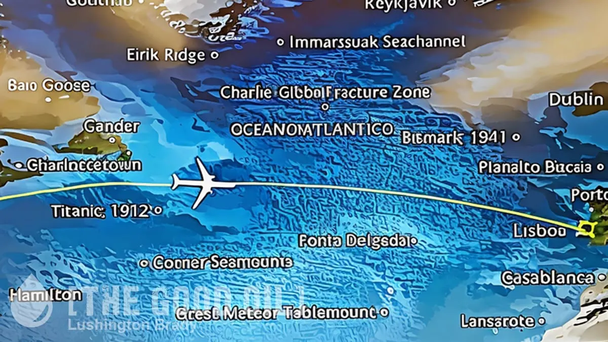
Taking the wildly inappropriate entertainment a step further, many airlines are including live flight maps on their in-flight entertainment. While it can be mildly interesting to keep track of exactly where you are in the world, passengers are noticing some slightly disconcerting details on maps.
These include such global tragedies as the sinking of the RMS Titanic in the North Atlantic Ocean in 1912 and the 1956 Andrea Doria disaster off the coast of Massachusetts.
Just wait until they finally find the wreckage of Malaysia Airlines Flight 370!
Unsurprisingly, the not-so-fun facts have left many passengers feeling a little unnerved.
“It is deeply weird that Emirates marks the sites of major shipwrecks on its flight tracker map. Who wants to think about deadly transportation disasters during a flight?”
Given shipwrecks are the result of major, often tragic, transportation disasters, why would they be pointed out to passengers mid-flight?
As it happens, there’s a very simple reason for all the shipwrecks on show: there’s pretty much nothing else of interest when you’re flying over water.
Rockwell Collins (now Collins Aerospace) is the company behind the in-flight entertainment systems used on major airlines, such as American Airlines, British Airways and China Eastern Airways, including the moving-map feature, Airshow.
Airshow program manager Clint Pine told Condé Nast Traveler in 2017 there was no dark explanation for the shipwreck details – they were simply to provide interesting bits of information to bored passengers on long trips.
“When travelling over the ocean, there are often large portions of the flight where only water is visible,” he said.
“Airshow includes shipwrecks and other undersea items so that passengers can be informed about items that they are flying over but cannot visually see.”
For instance, on a flight to Japan, I at least found it pretty interesting to know that the plane was right over the Mariana Trench. Hey, if the plane does go down, it’s going to go way, way down!
Other underwater features pointed out on Airshow maps included the underwater volcano cluster called the Bermuda Rise in the Atlantic Ocean and the Hudson Canyon, a 10,000-year-old underwater canyon off the coast of New York, according to Condé Nast Traveler.
Mr Pine added that maps had become more and more detailed, and the company had been looking to “add expanded geographic content so that passengers know exactly what they are seeing as they look through the window”.
Perhaps we can look forward to AR displays on the windows that will show graphic overlays of the ocean bottom, with all its ridges, trenches and underwater volcanoes.
Not to mention lots of shipwrecks.


