Table of Contents
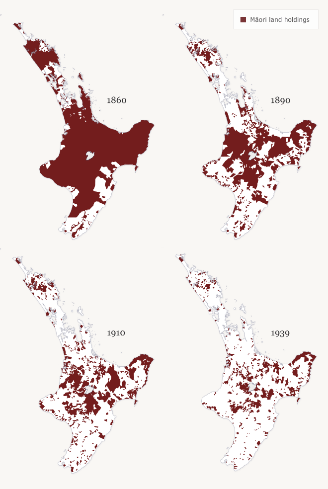
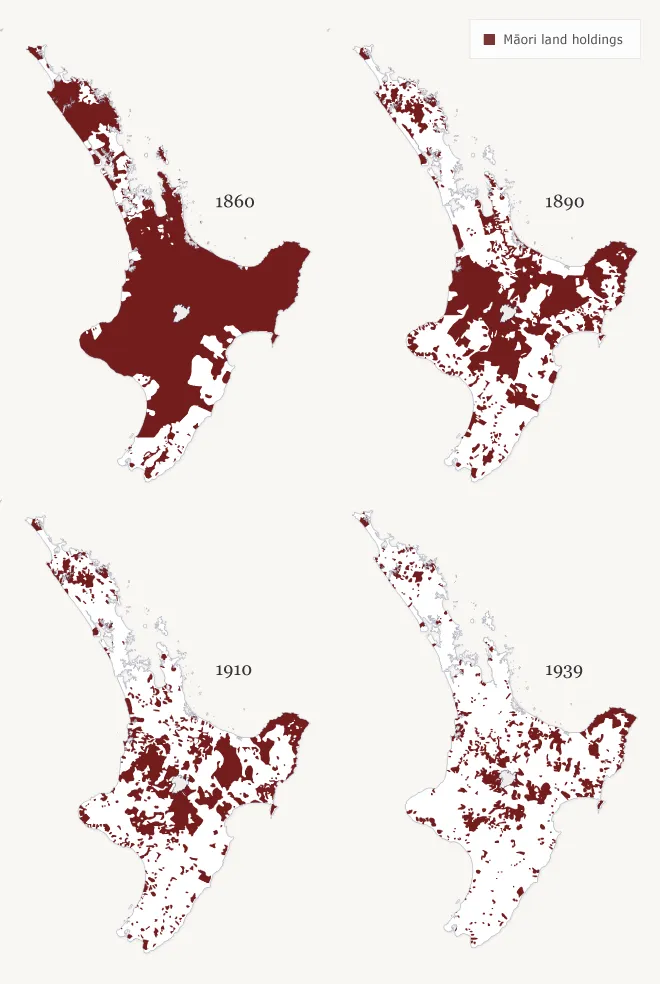
These maps illustrate the gradual alienation of M?ori land in the North Island. In 1860, M?ori still held onto most of their land, except for a few areas, particularly Wellington, Wairarapa, Hawke’s Bay and parts of Northland. The 1860s saw confiscations of huge areas by the government and large areas of land began to be lost through the effect of the Native Land Court. The period between 1890 and 1920 saw a boom in government land purchases, despite M?ori protests. By 1937, very little land was left in M?ori ownership.
teara.govt.nz/en/map/19476/loss-of-maori-land


