Skip to content

The BFD Map of the Day: 3D Australia on Fire

The BFD Map of the day

Table of Contents

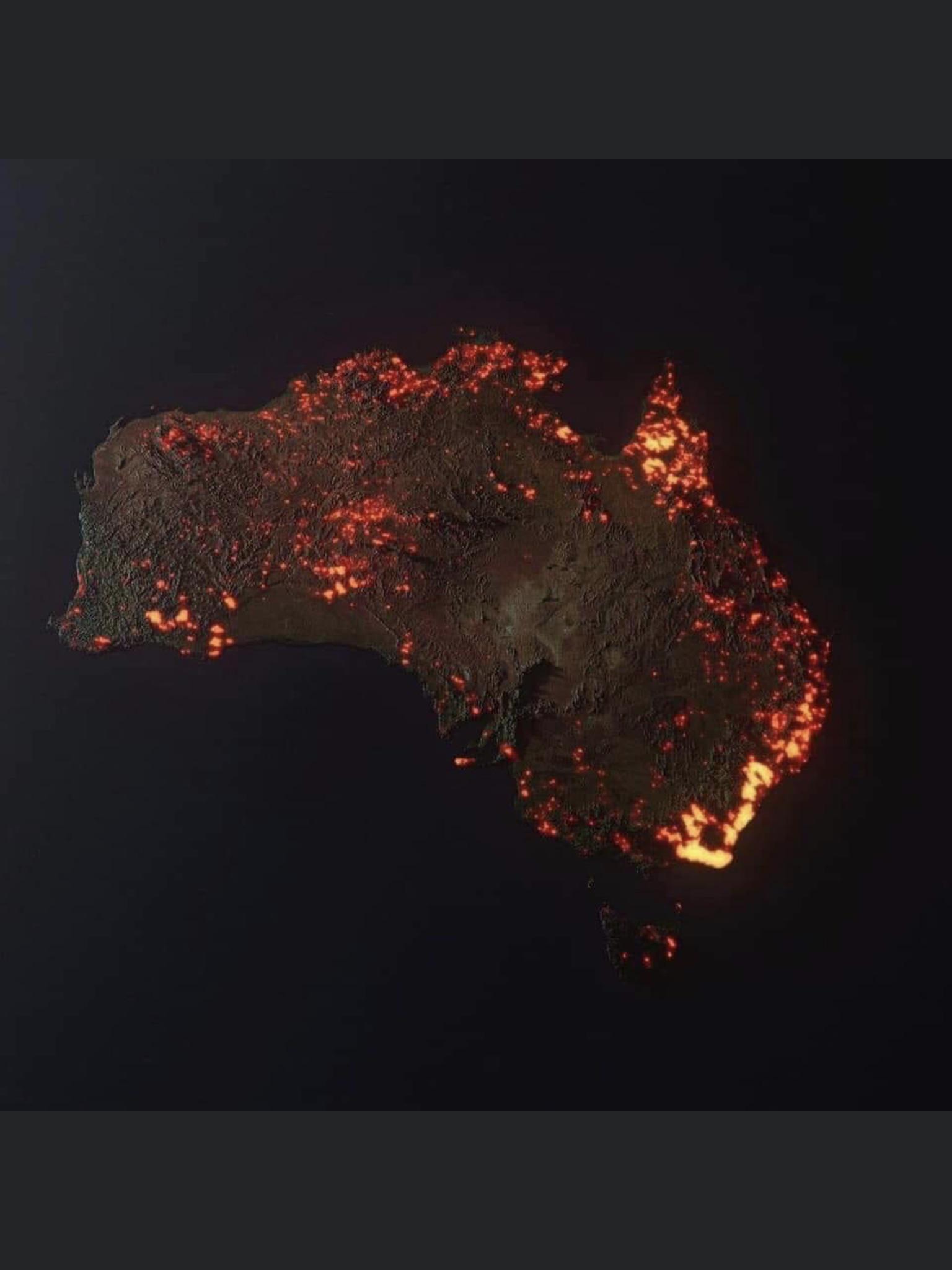
“3D “visualisation” of the fires in Australia, made from NASA satellite data. These are all the areas which have been affected, but not all the areas are still burning.”
Credit ~ Anthony Hearsey – Creative Imaging

reddit.com/r/MapPorn/comments/ekbtk0/3d_visualisation_of_the_fires_in_australia_made/
The BFD. Map of the day

Latest

Night Cap

Night Cap

If you have a great Youtube, Rumble or Vimeo video to share send it to videos@goodoil.news If you're loving this trusty, straight-up news on Kiwi politics and beyond, why not become a paid member, eh? Unlock exclusive yarns, podcasts, vids, and in-depth analysis—your support keeps

Members Public
Taste Tuesday

Taste Tuesday

If you have a great Youtube, Rumble or Vimeo video to share send it to videos@goodoil.news If you're loving this trusty, straight-up news on Kiwi politics and beyond, why not become a paid member, eh? Unlock exclusive yarns, podcasts, vids, and in-depth analysis—your support keeps

Members Public