Table of Contents
The notion of the “lost continent” of Lemuria was first put forward in the mid-19th century, attempting to explain the presence of lemur fossils in both Madagascar and India and nowhere in between. Zoologist Philip Sclater proposed that, like Atlantis, Lemuria had “sunk beneath the waves”, in what is now the Indian Ocean.
It’s now know that, rather than a now-sunken land bridge, plate tectonics is the answer to the lemur’s presence in two such widely-separate places. India and Madagascar were once both part of the supercontinent Gondwana, which broke up and drifted apart over tens of millions of years.
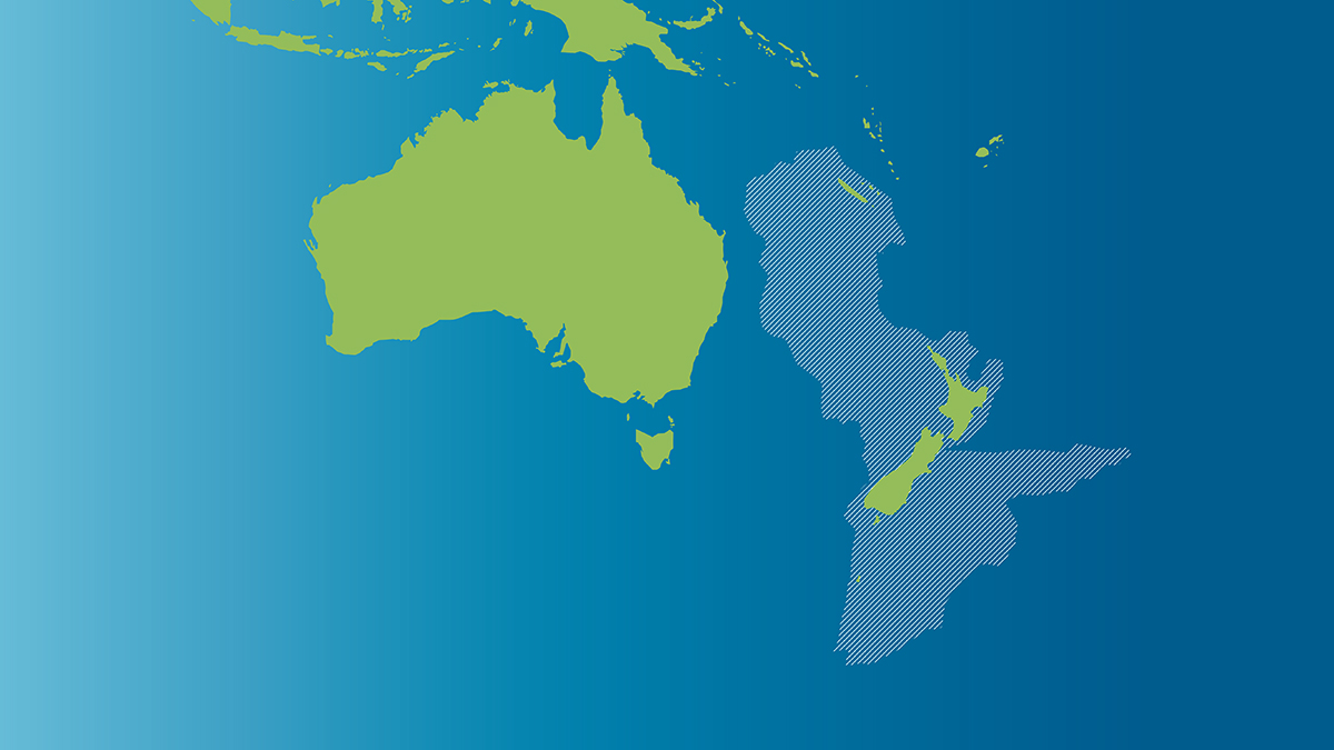
But there is a genuine “lost continent” now drowned under the Pacific: Zealandia.
When Gondwana began to split, Madagascar, India, Australia, Antarctica and New Zealand remained temporarily (in geologic time) joined as East Gondwana. That, too, split: but its history can still be seen by such remnants as the myrtle beech forests of Tasmania and New Zealand (fossil myrtle beech leaves have also been found in Antarctica). As Antarctica drifted south, it pulled off the chunk of Australia now known as Tasmania. To the east, another fragment of Gondwana was Zealandia.
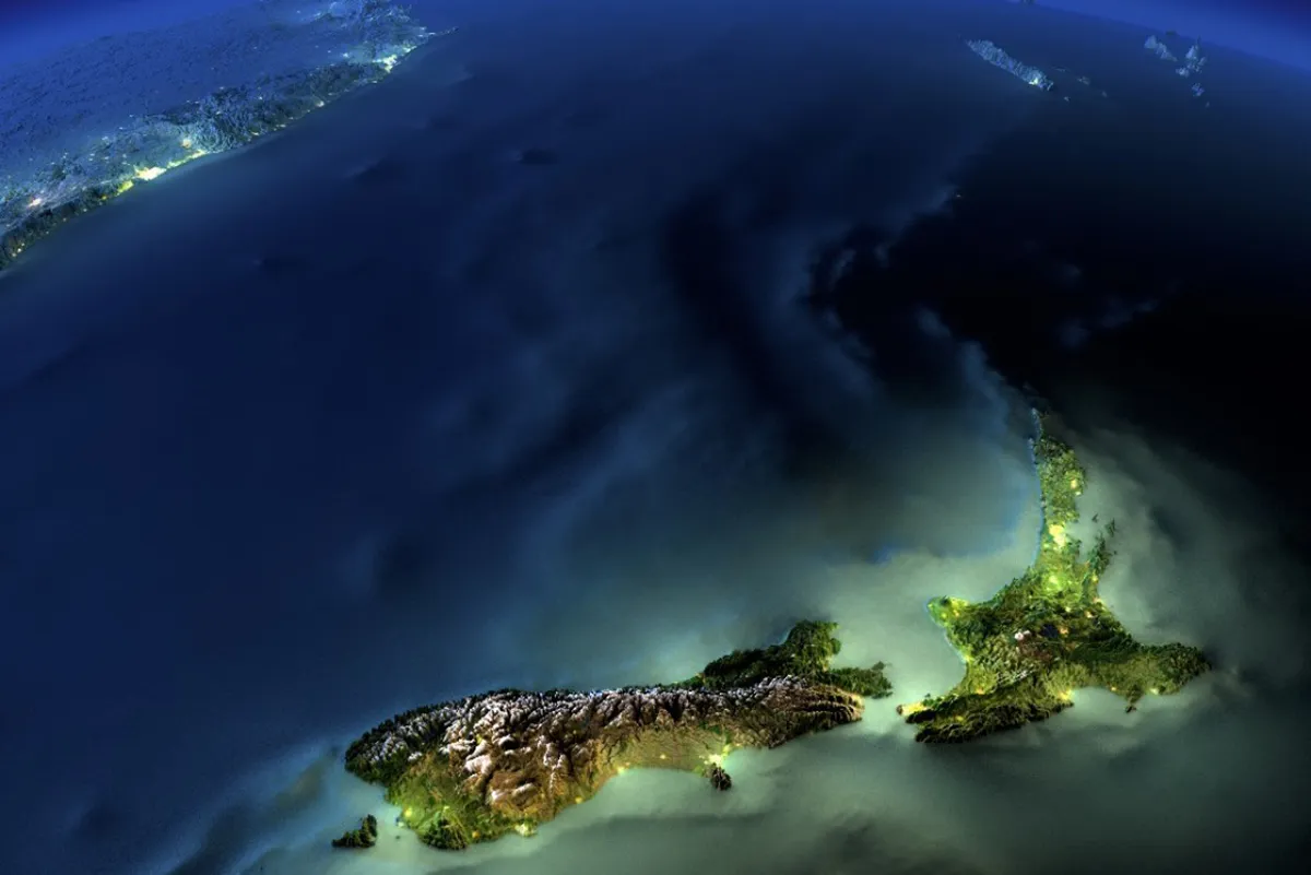
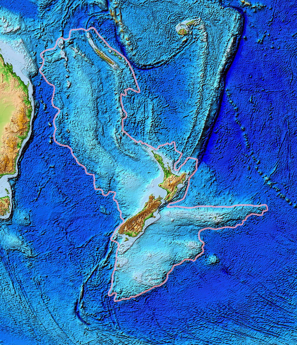
Most of Zealandia is today submerged beneath the Pacific. Only its former highlands remain above the waves. We know them as New Zealand and New Caledonia. Had Zealandia not sunk, there would be an eighth continent: an elongated chunk of land separated from Australia by a narrow strait and stretching from the tip of Queensland to far south of Tasmania.
But about 85 million years ago, two tectonic plates, the southern end of the Pacific Plate and the Indo-Australian plate began sliding past each other at the rate of a few millimetres a year. Over the next 20 million years, this slow drift pulled Zealandia away from Australia and caused it to sink. By the end of the dinosaurs, most of Zealandia was underwater.
This tectonic activity is what shaped New Zealand – and still is. Where plates grind against and over and under one another, there is volcanic and seismic activity, like the Pacific “Ring of Fire”. The Southern Alps are where Zealandia was pushed upward.
The existence of Zealandia was put together by decades of geologic detective work. As sonar and radar mapping of the ocean floor revealed details of its topography, scientists began to suspect that a lost continent indeed existed in the South Pacific. One telling clue was the otherwise anomalous geology of the undersea region. The floors of the ocean basins tend to be thinner, because tectonics is stretching them out. This oceanic crust also shows different geologic composition to continental crust.
But the rocks brought up from the ocean floor of what is now recognised as Zealandia are different from ocean crust. The crust is much thicker and of continental type.
As Einstein showed, mass affects gravity. Less dense oceanic crust therefore has a different gravity “signature” than continents, which can now be mapped by satellite. In 2002, satellite gravity measurements finally mapped the outlines of Zealandia.
In 2017, Zealandia was officially recognised as a continent.

Please share this article so that others can discover The BFD


