Skip to content
The BFD Map of the day

Table of Contents

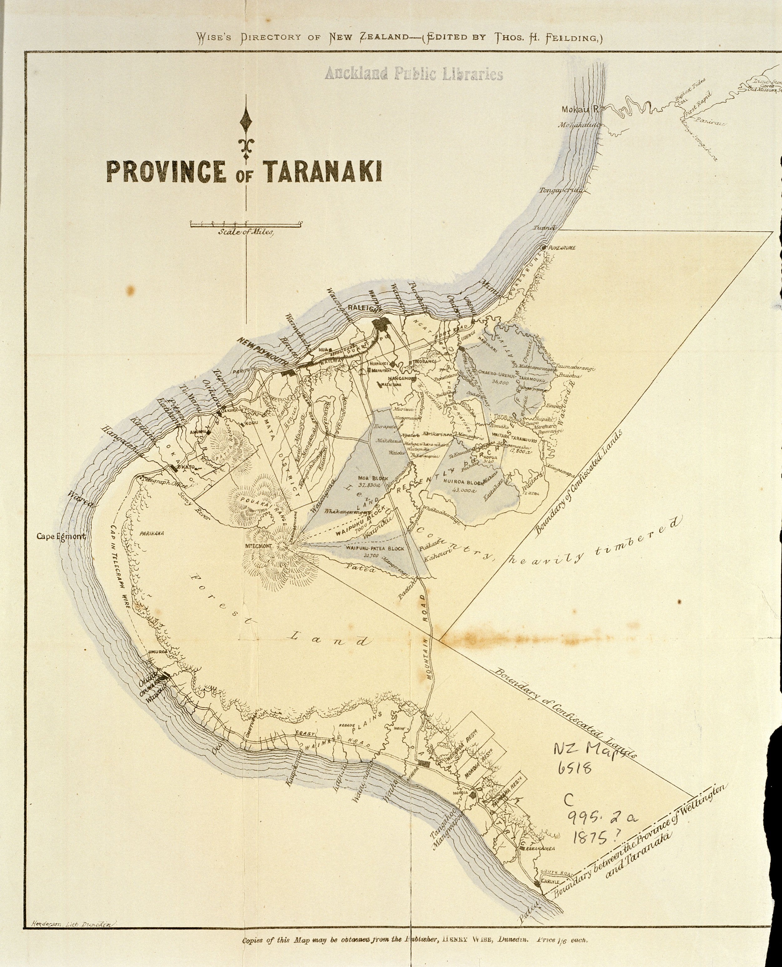
A map of Taranaki Province from 1875-76 Wise’s Post Office Directory of New Zealand, showing the confiscation boundary.

Source: Sir George Grey Special Collections, Auckland Libraries, NZ Map 6518.

The BFD. Map of the day. Source:external-preview.redd.it

If you enjoyed this BFD map of the day please consider sharing it with your friends.

Latest

Night Cap

Night Cap

If you have a great Youtube, Rumble or Vimeo video to share send it to videos@goodoil.news If you're loving this trusty, straight-up news on Kiwi politics and beyond, why not become a paid member, eh? Unlock exclusive yarns, podcasts, vids, and in-depth analysis—your support keeps

Members Public
Friday Fur

Friday Fur

If you have a great Youtube, Rumble or Vimeo video to share send it to videos@goodoil.news If you're loving this trusty, straight-up news on Kiwi politics and beyond, why not become a paid member, eh? Unlock exclusive yarns, podcasts, vids, and in-depth analysis—your support keeps

Members Public
Ban Electric Scooters Before More Kids Get Hurt!

Ban Electric Scooters Before More Kids Get Hurt!

If you have a great Youtube, Rumble or Vimeo video to share send it to videos@goodoil.news If you're loving this trusty, straight-up news on Kiwi politics and beyond, why not become a paid member, eh? Unlock exclusive yarns, podcasts, vids, and in-depth analysis—your support keeps

Members Public